
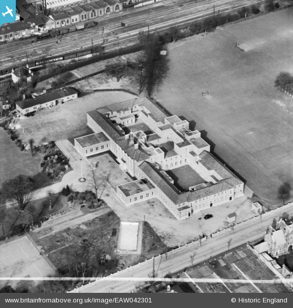
EAW042301 ENGLAND (1952). The Licensed Victuallers' School, Slough, 1952. This image was marked by Aerofilms Ltd for photo editing.
© Copyright OpenStreetMap contributors and licensed by the OpenStreetMap Foundation. 2024. Cartography is licensed as CC BY-SA.
Nearby Images (23)
EAW042301

EAW042300

EAW042302

EAW042293

EAW042295

EPW021898

EAW042294

EAW042297

EAW042296

EAW042299

EAW042298

EPW021899

EPW034719
 in flight above Slough Railway Station, Slough, from the south-west, 1930. This image has been produced from a damaged negative.")
EAW030169

EPW008020

EPW008022

EPW008024

EPW008023

EPW008025

EAW029473

EPW061201

EPW061199

EPW008021

Details
| Title | [EAW042301] The Licensed Victuallers' School, Slough, 1952. This image was marked by Aerofilms Ltd for photo editing. |
| Reference | EAW042301 |
| Date | 9-April-1952 |
| Link | |
| Place name | SLOUGH |
| Parish | |
| District | |
| Country | ENGLAND |
| Easting / Northing | 497940, 180005 |
| Longitude / Latitude | -0.58854367967909, 51.509992181749 |
| National Grid Reference | SU979800 |
Pins
Be the first to add a comment to this image!


