
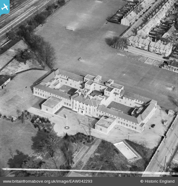
EAW042293 ENGLAND (1952). The Licensed Victuallers' School, Slough, 1952. This image was marked by Aerofilms Ltd for photo editing.
© Copyright OpenStreetMap contributors and licensed by the OpenStreetMap Foundation. 2024. Cartography is licensed as CC BY-SA.
Nearby Images (21)
EAW042293

EAW042295

EAW042302

EAW042301

EAW042300

EAW042294

EAW042297

EAW042296

EAW042299

EAW042298

EPW021898

EPW021899

EPW034719
 in flight above Slough Railway Station, Slough, from the south-west, 1930. This image has been produced from a damaged negative.")
EPW008020

EPW008024

EPW008022

EPW008023

EAW030169

EPW008025

EPW008021

EPW061201

Details
| Title | [EAW042293] The Licensed Victuallers' School, Slough, 1952. This image was marked by Aerofilms Ltd for photo editing. |
| Reference | EAW042293 |
| Date | 9-April-1952 |
| Link | |
| Place name | SLOUGH |
| Parish | |
| District | |
| Country | ENGLAND |
| Easting / Northing | 497963, 180016 |
| Longitude / Latitude | -0.58820926779196, 51.510087081014 |
| National Grid Reference | SU980800 |
Pins

User Comment Contributions
previously an orphans home now tescos |
 dave43 |
Friday 25th of April 2014 08:48:43 PM |


