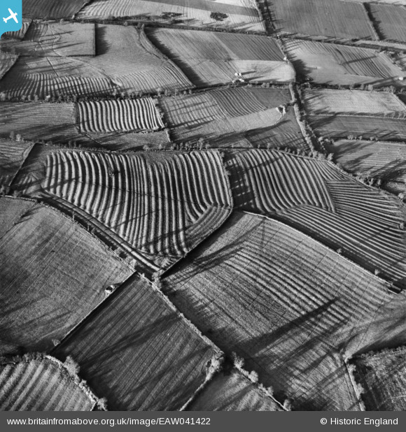
EAW041422 ENGLAND (1951). Ridge and Furrow in fields east of Moreton Pinkney, 1951. This image has been produced from a damaged negative.
© Copyright OpenStreetMap contributors and licensed by the OpenStreetMap Foundation. 2024. Cartography is licensed as CC BY-SA.
Details
| Title | [EAW041422] Ridge and Furrow in fields east of Moreton Pinkney, 1951. This image has been produced from a damaged negative. |
| Reference | EAW041422 |
| Date | 6-December-1951 |
| Link | |
| Place name | MORETON PINKNEY |
| Parish | MORETON PINKNEY |
| District | |
| Country | ENGLAND |
| Easting / Northing | 458271, 249183 |
| Longitude / Latitude | -1.1484941003713, 52.137458821989 |
| National Grid Reference | SP583492 |
Pins
 Dave Brunt |
Monday 29th of December 2014 06:48:17 PM | |
 Dave Brunt |
Monday 29th of December 2014 06:47:48 PM | |
 Class31 |
Monday 28th of April 2014 10:43:36 AM | |
Stratford-upon-Avon and Midland Junction Railway |
 Dave Brunt |
Monday 29th of December 2014 06:49:27 PM |
User Comment Contributions
Very well-developed ridge and furrow field systems. These should be easily identified by an expert in the history of r&f! (Maybe Leicestershire, a wild hunch ...) |
 Rebecca |
Thursday 11th of December 2014 11:33:42 AM |
Both images show same fields, EAW041421 EAW041422 |
 TomRobin |
Monday 14th of July 2014 07:02:32 PM |


![[EAW041422] Ridge and Furrow in fields east of Moreton Pinkney, 1951. This image has been produced from a damaged negative.](http://britainfromabove.org.uk/sites/all/libraries/aerofilms-images/public/100x100/EAW/041/EAW041422.jpg)
![[EAW041421] Ridge and Furrow in fields east of Moreton Pinkney, 1951. This image has been produced from a damaged negative.](http://britainfromabove.org.uk/sites/all/libraries/aerofilms-images/public/100x100/EAW/041/EAW041421.jpg)


