
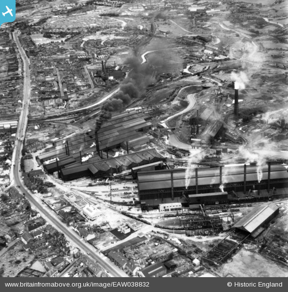
EAW038832 ENGLAND (1951). Round Oak Iron and Steel Works and Dudley Road, Brierley Hill, 1951. This image has been produced from a print.
© Copyright OpenStreetMap contributors and licensed by the OpenStreetMap Foundation. 2024. Cartography is licensed as CC BY-SA.
Nearby Images (26)
EAW038832

EAW008343

EAW008342

EAW038830

EAW008338

EAW008349

EAW038824

EAW038831

EAW008339

EAW008351

EAW008344

EAW008350

EAW038825

EAW008347

EAW038833

EAW008346

EAW008341

EAW038827

EAW008348

EAW008345

EAW008340

EAW038834

EAW038836

EAW038837

EAW038835

EAW038844

Details
| Title | [EAW038832] Round Oak Iron and Steel Works and Dudley Road, Brierley Hill, 1951. This image has been produced from a print. |
| Reference | EAW038832 |
| Date | 15-August-1951 |
| Link | |
| Place name | BRIERLEY HILL |
| Parish | |
| District | |
| Country | ENGLAND |
| Easting / Northing | 392168, 287741 |
| Longitude / Latitude | -2.1153523864845, 52.487161460881 |
| National Grid Reference | SO922877 |
Pins
 John Wass |
Tuesday 7th of February 2017 09:23:44 PM |


