
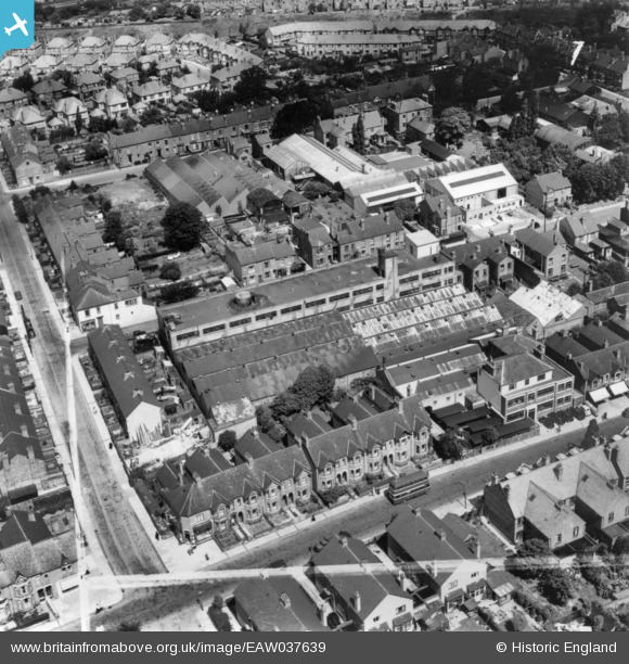
EAW037639 ENGLAND (1951). The Engineering Works on Earlsdon Street and environs, Coventry, 1951. This image has been produced from a print marked by Aerofilms Ltd for photo editing.
© Copyright OpenStreetMap contributors and licensed by the OpenStreetMap Foundation. 2024. Cartography is licensed as CC BY-SA.
Nearby Images (8)
EAW037639

EAW037642

EAW037643

EAW037641

EAW037640

EAW037646

EAW037644

EAW037645

Details
| Title | [EAW037639] The Engineering Works on Earlsdon Street and environs, Coventry, 1951. This image has been produced from a print marked by Aerofilms Ltd for photo editing. |
| Reference | EAW037639 |
| Date | 2-July-1951 |
| Link | |
| Place name | COVENTRY |
| Parish | |
| District | |
| Country | ENGLAND |
| Easting / Northing | 431801, 277949 |
| Longitude / Latitude | -1.5325646337228, 52.398253128131 |
| National Grid Reference | SP318779 |
Pins
Be the first to add a comment to this image!


