
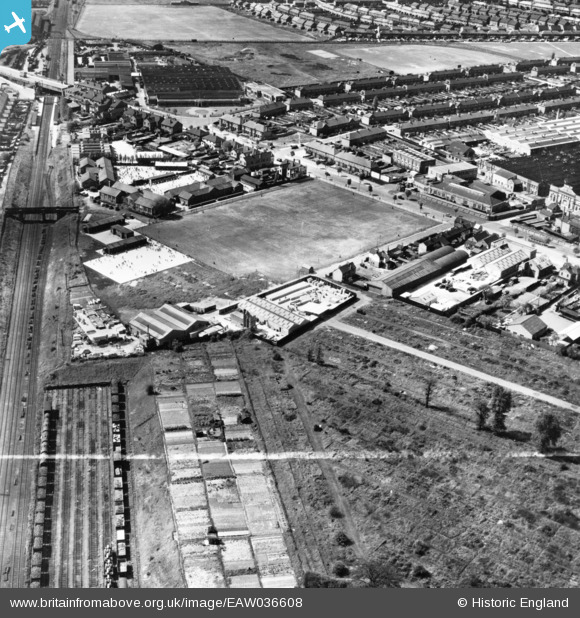
EAW036608 ENGLAND (1951). The Ernest Batley Ltd Concrete Works, Colledge Road and environs, Whitmore Park, 1951. This image has been produced from a print marked by Aerofilms Ltd for photo editing.
© Copyright OpenStreetMap contributors and licensed by the OpenStreetMap Foundation. 2024. Cartography is licensed as CC BY-SA.
Nearby Images (20)
EAW036608

EAW036607

EAW036606

EAW036605

EAW036602

EAW036603

EAW036609

EAW036601

EAW036604

EPW049476

EPW049477

EPW049475

EPW056082

EPW049474

EPW027063

EPW027061

EPW027062

EPW027057

EPW027064

EPW027066

Details
| Title | [EAW036608] The Ernest Batley Ltd Concrete Works, Colledge Road and environs, Whitmore Park, 1951. This image has been produced from a print marked by Aerofilms Ltd for photo editing. |
| Reference | EAW036608 |
| Date | 31-May-1951 |
| Link | |
| Place name | WHITMORE PARK |
| Parish | |
| District | |
| Country | ENGLAND |
| Easting / Northing | 433767, 282176 |
| Longitude / Latitude | -1.5032411220755, 52.436139309941 |
| National Grid Reference | SP338822 |
Pins
Be the first to add a comment to this image!


