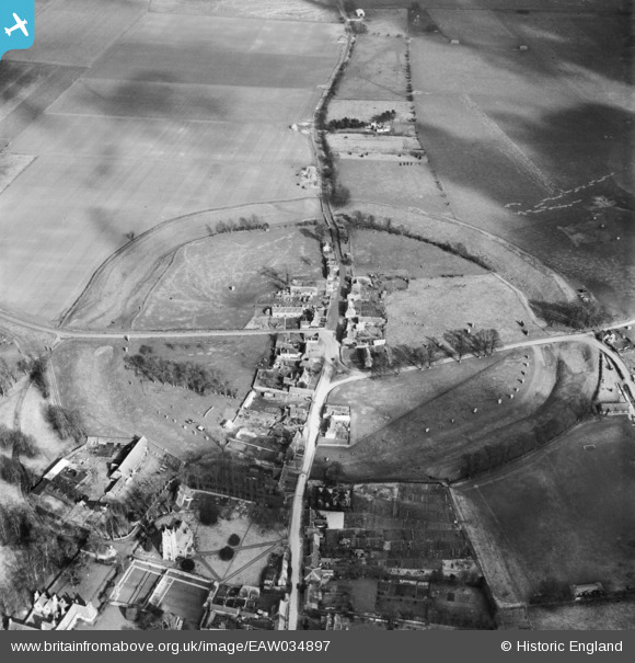
EAW034897 ENGLAND (1951). The henge and village, Avebury, 1951
© Copyright OpenStreetMap contributors and licensed by the OpenStreetMap Foundation. 2024. Cartography is licensed as CC BY-SA.
Nearby Images (16)
EAW034897

EAW007046

EAW007055

EAW007057

EAW034899

EAW034898

EAW007049

EAW007056

EAW007048

EAW007047

EAW007058

EAW049153

EAW049152

EAW049151

EAW049154

EAW007054

Details
| Title | [EAW034897] The henge and village, Avebury, 1951 |
| Reference | EAW034897 |
| Date | 12-March-1951 |
| Link | |
| Place name | AVEBURY |
| Parish | AVEBURY |
| District | |
| Country | ENGLAND |
| Easting / Northing | 410248, 169977 |
| Longitude / Latitude | -1.8525786738006, 51.428213991656 |
| National Grid Reference | SU102700 |
Pins
 Class31 |
Tuesday 9th of December 2014 03:59:54 PM |