
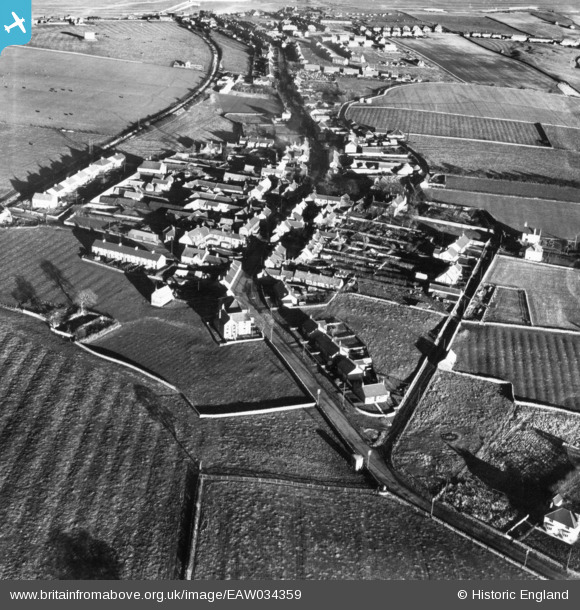
EAW034359 ENGLAND (1950). The village, North Sunderland, 1950. This image has been produced from a print.
© Copyright OpenStreetMap contributors and licensed by the OpenStreetMap Foundation. 2024. Cartography is licensed as CC BY-SA.
Nearby Images (3)
EAW034359

EAW034358

EAW034360

Details
| Title | [EAW034359] The village, North Sunderland, 1950. This image has been produced from a print. |
| Reference | EAW034359 |
| Date | 25-November-1950 |
| Link | |
| Place name | NORTH SUNDERLAND |
| Parish | NORTH SUNDERLAND |
| District | |
| Country | ENGLAND |
| Easting / Northing | 421005, 631414 |
| Longitude / Latitude | -1.6668135407109, 55.575927719914 |
| National Grid Reference | NU210314 |
Pins
 Matt Aldred edob.mattaldred.com |
Thursday 31st of December 2020 03:56:20 PM | |
 redmist |
Monday 28th of September 2020 08:16:55 AM | |
redmist |
Saturday 26th of September 2020 05:11:07 PM |


