
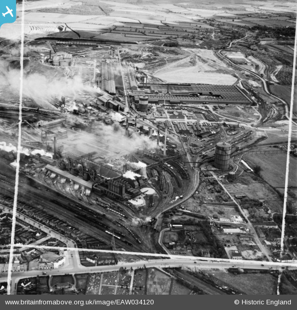
EAW034120 ENGLAND (1950). Stewarts and Lloyds Ltd Iron & Steel Works, Corby, 1950. This image was marked by Aerofilms Ltd for photo editing.
© Copyright OpenStreetMap contributors and licensed by the OpenStreetMap Foundation. 2024. Cartography is licensed as CC BY-SA.
Nearby Images (21)
EAW034120

EAW034113

EPW049771

EPW054913

EAW034119

EAW034115

EAW034117

EAW034123

EAW034116

EPW049774

EAW034121

EPW049775

EPW049772

EAW034114

EAW034118

EPW054923

EAW045576

EPW049770

EPW054912

EPW049767

EPW049765

Details
| Title | [EAW034120] Stewarts and Lloyds Ltd Iron & Steel Works, Corby, 1950. This image was marked by Aerofilms Ltd for photo editing. |
| Reference | EAW034120 |
| Date | 26-October-1950 |
| Link | |
| Place name | CORBY |
| Parish | |
| District | |
| Country | ENGLAND |
| Easting / Northing | 489843, 289416 |
| Longitude / Latitude | -0.67649976403799, 52.494875858232 |
| National Grid Reference | SP898894 |
Pins
Be the first to add a comment to this image!


