
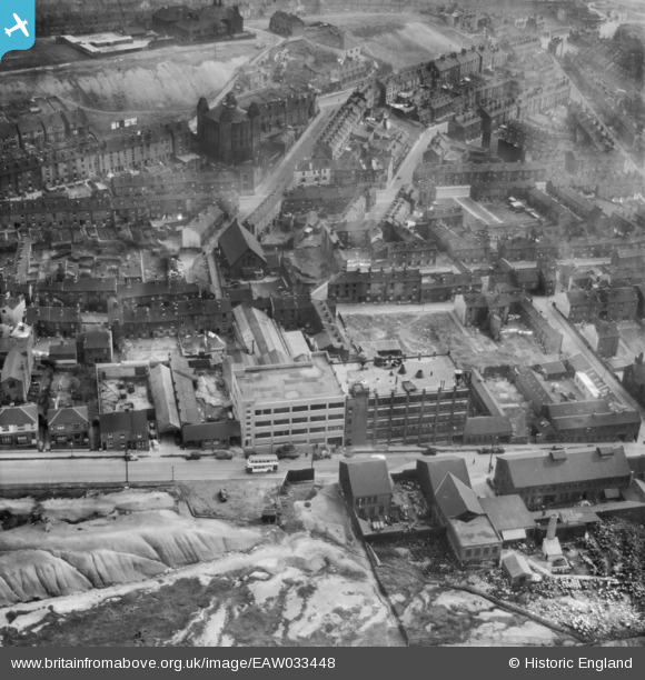
EAW033448 ENGLAND (1950). The Stanley Tool Works on Rutland Road and environs, Sheffield, 1950
© Copyright OpenStreetMap contributors and licensed by the OpenStreetMap Foundation. 2024. Cartography is licensed as CC BY-SA.
Nearby Images (8)
EAW033448

EAW033449

EAW033450

EAW033451

EAW033445

EAW033446

EAW033447

EAW033444

Details
| Title | [EAW033448] The Stanley Tool Works on Rutland Road and environs, Sheffield, 1950 |
| Reference | EAW033448 |
| Date | 12-October-1950 |
| Link | |
| Place name | SHEFFIELD |
| Parish | |
| District | |
| Country | ENGLAND |
| Easting / Northing | 435269, 388903 |
| Longitude / Latitude | -1.4695497494247, 53.395516811992 |
| National Grid Reference | SK353889 |


