
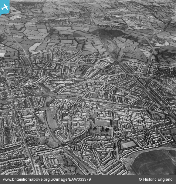
EAW033379 ENGLAND (1950). Burnt Oak, Edgware and environs, Burnt Oak, from the south-east, 1950
© Copyright OpenStreetMap contributors and licensed by the OpenStreetMap Foundation. 2024. Cartography is licensed as CC BY-SA.
Nearby Images (6)
EAW033379

EAW027668
 in flight over the Watling Park area, Burnt Oak, from the west, 1949")
EAW033378

EPW008004

EPW009355

EPW035547

Details
| Title | [EAW033379] Burnt Oak, Edgware and environs, Burnt Oak, from the south-east, 1950 |
| Reference | EAW033379 |
| Date | 10-October-1950 |
| Link | |
| Place name | BURNT OAK |
| Parish | |
| District | |
| Country | ENGLAND |
| Easting / Northing | 520443, 191242 |
| Longitude / Latitude | -0.26053858781304, 51.606644275979 |
| National Grid Reference | TQ204912 |
Pins
 sashmantitch |
Thursday 13th of June 2019 10:07:37 PM | |
 Class31 |
Wednesday 30th of April 2014 10:40:07 AM |


