
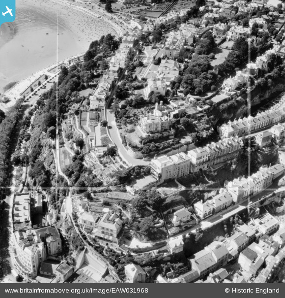
EAW031968 ENGLAND (1950). Waldon Castle Hotel and the surrounding residential area, Torquay, 1950. This image was marked by Aerofilms Ltd for photo editing.
© Copyright OpenStreetMap contributors and licensed by the OpenStreetMap Foundation. 2024. Cartography is licensed as CC BY-SA.
Nearby Images (25)
EAW031968

EAW031965

EAW031966

EAW031967

EAW031964

EPR000334

EPR000343

EPR000339

EPW011338

EPR000341

EAW030859

EAW011686

EPR000344A

EPW023718

EPR000340

EPR000342

EAW011688

EPW023730

EAW031975

EAW011689

EAW030860

EAW031974

EPR000329

EPW023725

EAW011840

Details
| Title | [EAW031968] Waldon Castle Hotel and the surrounding residential area, Torquay, 1950. This image was marked by Aerofilms Ltd for photo editing. |
| Reference | EAW031968 |
| Date | 17-August-1950 |
| Link | |
| Place name | TORQUAY |
| Parish | |
| District | |
| Country | ENGLAND |
| Easting / Northing | 291652, 63623 |
| Longitude / Latitude | -3.5266764979328, 50.461813960066 |
| National Grid Reference | SX917636 |
Pins
Be the first to add a comment to this image!


