
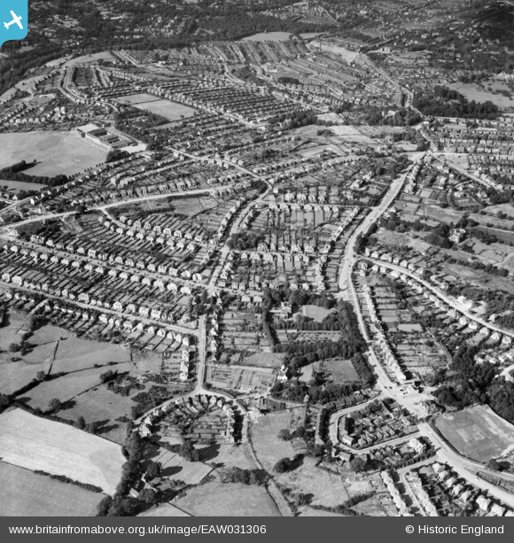
EAW031306 ENGLAND (1950). Broad Elms Lane, Ecclesall Road South and environs, Ecclesall, 1950
© Copyright OpenStreetMap contributors and licensed by the OpenStreetMap Foundation. 2024. Cartography is licensed as CC BY-SA.
Nearby Images (4)
EAW031306

EAW031307

EAW031308

EAW031309

Details
| Title | [EAW031306] Broad Elms Lane, Ecclesall Road South and environs, Ecclesall, 1950 |
| Reference | EAW031306 |
| Date | 26-July-1950 |
| Link | |
| Place name | ECCLESALL |
| Parish | |
| District | |
| Country | ENGLAND |
| Easting / Northing | 431914, 384003 |
| Longitude / Latitude | -1.5205022985413, 53.35168255275 |
| National Grid Reference | SK319840 |
Pins
 Catt |
Wednesday 11th of September 2019 08:59:17 PM | |
AndNew |
Tuesday 17th of April 2018 08:52:31 PM | |
 Nick Ashton-Jones |
Sunday 21st of September 2014 12:53:27 PM | |
Nick Ashton-Jones |
Sunday 21st of September 2014 12:52:39 PM | |
Nick Ashton-Jones |
Sunday 21st of September 2014 12:51:44 PM |


