
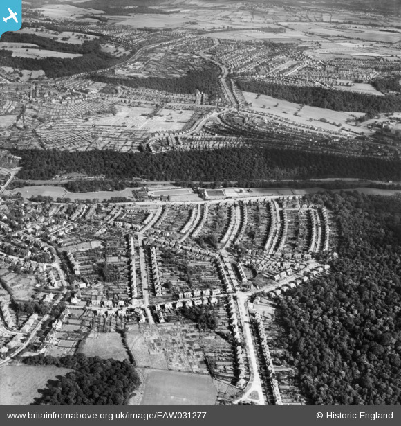
EAW031277 ENGLAND (1950). Hutcliffe Wood, Millhouses and environs, Sheffield, 1950
© Copyright OpenStreetMap contributors and licensed by the OpenStreetMap Foundation. 2024. Cartography is licensed as CC BY-SA.
Nearby Images (7)
EAW031277

EAW031278

EAW031276

EAW031275

EPW020407

EPW020409

EPW020408

Details
| Title | [EAW031277] Hutcliffe Wood, Millhouses and environs, Sheffield, 1950 |
| Reference | EAW031277 |
| Date | 26-July-1950 |
| Link | |
| Place name | SHEFFIELD |
| Parish | |
| District | |
| Country | ENGLAND |
| Easting / Northing | 433233, 382924 |
| Longitude / Latitude | -1.5007988669874, 53.341901783012 |
| National Grid Reference | SK332829 |
Pins
 redmist |
Wednesday 7th of November 2018 10:41:30 AM | |
llan |
Friday 8th of December 2017 02:19:06 PM | |
llan |
Friday 8th of December 2017 02:11:32 PM | |
llan |
Friday 8th of December 2017 02:07:47 PM | |
llan |
Sunday 26th of November 2017 12:47:28 PM | |
llan |
Sunday 26th of November 2017 12:45:03 PM | |
llan |
Sunday 26th of November 2017 12:43:12 PM |


