
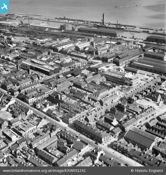
EAW031241 ENGLAND (1950). Construction underway at the Smith and Nephew Ltd Paragon Works site, Kingston upon Hull, 1950
© Copyright OpenStreetMap contributors and licensed by the OpenStreetMap Foundation. 2024. Cartography is licensed as CC BY-SA.
Nearby Images (30)
EAW031241

EAW031233

EAW031235

EAW031239

EAW035534

EAW035536

EAW031237

EAW043298

EAW031236

EAW043299

EAW035532

EAW031240

EAW031238

EAW035528

EAW043293

EAW043296

EAW031234

EAW035531

EAW035533

EAW035530

EAW043300

EAW035529

EAW043297

EAW035535

EAW043294

EAW043295

EPW055048

EPW009399

EAW015637

EPW009398

Details
| Title | [EAW031241] Construction underway at the Smith and Nephew Ltd Paragon Works site, Kingston upon Hull, 1950 |
| Reference | EAW031241 |
| Date | 25-July-1950 |
| Link | |
| Place name | KINGSTON UPON HULL |
| Parish | |
| District | |
| Country | ENGLAND |
| Easting / Northing | 508629, 427943 |
| Longitude / Latitude | -0.35295802632876, 53.736321526182 |
| National Grid Reference | TA086279 |
Pins
 John Wass |
Tuesday 24th of June 2014 03:49:48 PM |


