
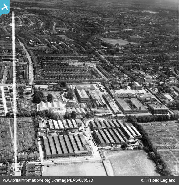
EAW030523 ENGLAND (1950). The London Electric Wire Co and Smiths Works and the surrounding area, Leyton, 1950. This image was marked by Aerofilms Ltd for photo editing.
© Copyright OpenStreetMap contributors and licensed by the OpenStreetMap Foundation. 2024. Cartography is licensed as CC BY-SA.
Nearby Images (25)
EAW030523

EAW030522

EPW008351

EAW030520

EAW030517

EPW008513

EAW030525

EAW030519

EPW016682

EAW030516

EPW016677

EPW008516

EPW008514

EPW008515

EAW030521

EAW030524

EPW016676

EPW016680

EPW016681

EPW016675

EPW008518

EAW030518

EPW016679

EPW016683

EPW016685

Details
| Title | [EAW030523] The London Electric Wire Co and Smiths Works and the surrounding area, Leyton, 1950. This image was marked by Aerofilms Ltd for photo editing. |
| Reference | EAW030523 |
| Date | 26-June-1950 |
| Link | |
| Place name | LEYTON |
| Parish | |
| District | |
| Country | ENGLAND |
| Easting / Northing | 537142, 187179 |
| Longitude / Latitude | -0.021101490985075, 51.566310220577 |
| National Grid Reference | TQ371872 |
 8-2007.JPG)


