
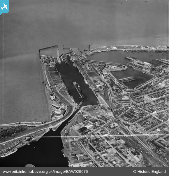
EAW029076 ENGLAND (1950). The Royal Dock and environs, Grimsby, 1950. This image was marked by Aerofilms Ltd for photo editing.
© Copyright OpenStreetMap contributors and licensed by the OpenStreetMap Foundation. 2024. Cartography is licensed as CC BY-SA.
Nearby Images (5)
EAW029076

EAW029012

EAW029015

EPW053393

EAW029069

Details
| Title | [EAW029076] The Royal Dock and environs, Grimsby, 1950. This image was marked by Aerofilms Ltd for photo editing. |
| Reference | EAW029076 |
| Date | 10-May-1950 |
| Link | |
| Place name | GRIMSBY |
| Parish | |
| District | |
| Country | ENGLAND |
| Easting / Northing | 527687, 410863 |
| Longitude / Latitude | -0.07118668540657, 53.578554823791 |
| National Grid Reference | TA277109 |
Pins
 redmist |
Wednesday 31st of October 2018 09:22:19 PM | |
redmist |
Wednesday 31st of October 2018 09:22:18 PM | |
JL |
Tuesday 5th of May 2015 06:46:40 AM | |
JL |
Tuesday 5th of May 2015 06:38:22 AM | |
 Class31 |
Tuesday 4th of March 2014 06:56:00 PM | |
Class31 |
Monday 3rd of March 2014 07:54:38 PM | |
Class31 |
Monday 3rd of March 2014 07:46:44 PM | |
Class31 |
Monday 3rd of March 2014 07:46:27 PM |


