
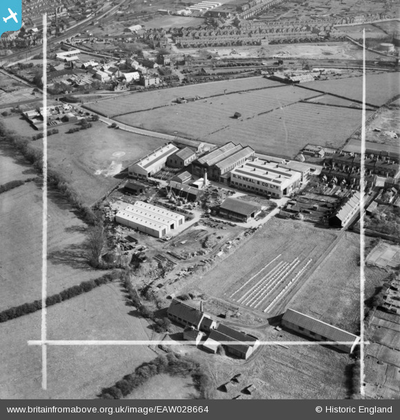
EAW028664 ENGLAND (1950). The R. H. Neal and Co Dysart Road Iron Works, Grantham, 1950. This image was marked by Aerofilms Ltd for photo editing.
© Copyright OpenStreetMap contributors and licensed by the OpenStreetMap Foundation. 2024. Cartography is licensed as CC BY-SA.
Nearby Images (8)
EAW028664

EAW028667

EAW028661

EAW028662

EAW028665

EAW028663

EAW028668

EAW028666

Details
| Title | [EAW028664] The R. H. Neal and Co Dysart Road Iron Works, Grantham, 1950. This image was marked by Aerofilms Ltd for photo editing. |
| Reference | EAW028664 |
| Date | 19-April-1950 |
| Link | |
| Place name | GRANTHAM |
| Parish | |
| District | |
| Country | ENGLAND |
| Easting / Northing | 490571, 335753 |
| Longitude / Latitude | -0.65301419486407, 52.911241910477 |
| National Grid Reference | SK906358 |
Pins
 redmist |
Tuesday 26th of October 2021 11:49:57 PM | |
millington |
Sunday 18th of October 2015 09:21:13 PM | |
ECML |
Sunday 17th of August 2014 05:16:55 PM | |
ECML |
Sunday 17th of August 2014 05:12:55 PM | |
Reiverside |
Tuesday 27th of May 2014 06:55:44 PM |


