
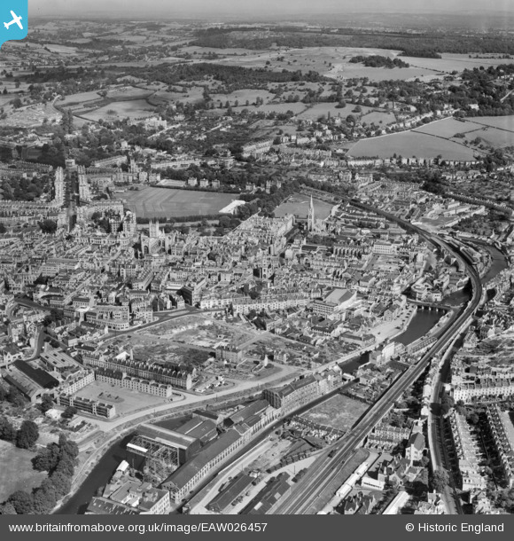
EAW026457 ENGLAND (1949). The city centre, Bath, from the west, 1949
© Copyright OpenStreetMap contributors and licensed by the OpenStreetMap Foundation. 2024. Cartography is licensed as CC BY-SA.
Nearby Images (17)
EAW026457

EAW026458

EPW001944

EAW002945

EAW023888

EAW023889

EAW023886

EAW002940

EAW002944

EPR000130

EPW001169

EAW002941

EAW023887

EAW026456

EAW002942

EAW002939

EPW033156

Details
| Title | [EAW026457] The city centre, Bath, from the west, 1949 |
| Reference | EAW026457 |
| Date | 8-September-1949 |
| Link | |
| Place name | BATH |
| Parish | |
| District | |
| Country | ENGLAND |
| Easting / Northing | 374773, 164512 |
| Longitude / Latitude | -2.3625078574807, 51.378601120448 |
| National Grid Reference | ST748645 |
Pins
 Class31 |
Tuesday 3rd of March 2015 10:49:23 PM | |
Class31 |
Wednesday 16th of July 2014 08:14:11 AM | |
Class31 |
Tuesday 15th of July 2014 11:14:32 PM | |
Class31 |
Tuesday 15th of July 2014 11:10:19 PM | |
Class31 |
Tuesday 15th of July 2014 11:08:47 PM | |
 MB |
Wednesday 5th of March 2014 11:17:04 AM | |
MB |
Wednesday 5th of March 2014 11:14:51 AM | |
MB |
Wednesday 5th of March 2014 11:14:22 AM |


User Comment Contributions
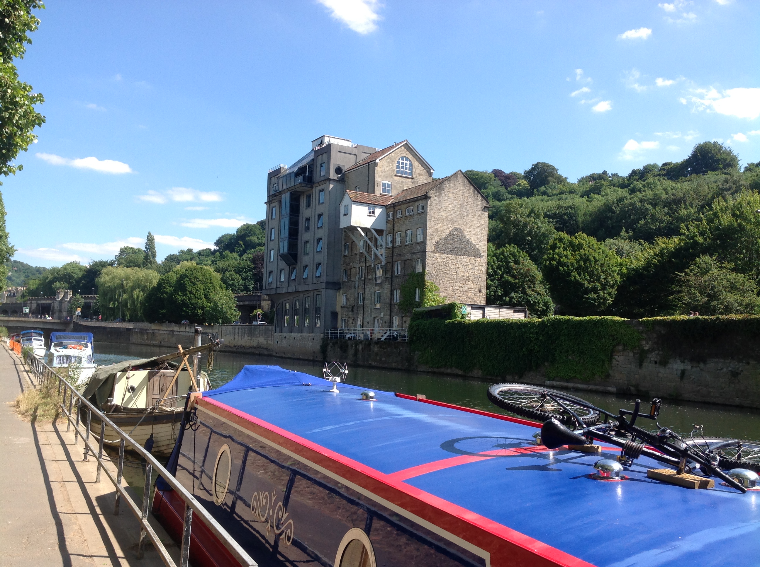 Warehouses alongside the River Avon, Bath, 15/07/2014 |
Class31 |
Tuesday 15th of July 2014 11:12:53 PM |


