
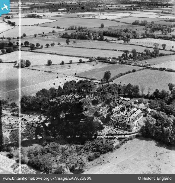
EAW025869 ENGLAND (1949). Kerrison School, Thorndon, 1949. This image has been produced from a damaged negative.
© Copyright OpenStreetMap contributors and licensed by the OpenStreetMap Foundation. 2024. Cartography is licensed as CC BY-SA.
Nearby Images (4)
EAW025869

EAW025868

EAW025870

EAW025871

Details
| Title | [EAW025869] Kerrison School, Thorndon, 1949. This image has been produced from a damaged negative. |
| Reference | EAW025869 |
| Date | 10-August-1949 |
| Link | |
| Place name | THORNDON |
| Parish | THORNDON |
| District | |
| Country | ENGLAND |
| Easting / Northing | 613329, 270338 |
| Longitude / Latitude | 1.1283558898717, 52.289301439496 |
| National Grid Reference | TM133703 |
Pins
Be the first to add a comment to this image!


