
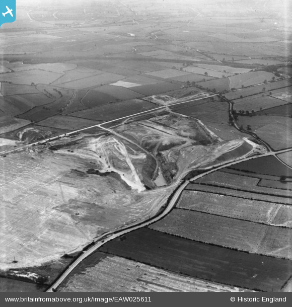
EAW025611 ENGLAND (1949). Billingley, Open Cast Coal Quarry south of the village, 1949. This image has been produced from a print.
© Copyright OpenStreetMap contributors and licensed by the OpenStreetMap Foundation. 2024. Cartography is licensed as CC BY-SA.
Nearby Images (19)
EAW025611

EAW025615

EAW015487

EAW025622

EAW025623

EAW025624

EAW015488

EAW015495

EAW025626

EAW025630

EAW015496

EAW025627

EAW025628

EAW025629

EAW025625

EAW025632

EAW015484

EAW015499

EAW015500

Details
| Title | [EAW025611] Billingley, Open Cast Coal Quarry south of the village, 1949. This image has been produced from a print. |
| Reference | EAW025611 |
| Date | 4-August-1949 |
| Link | |
| Place name | BILLINGLEY |
| Parish | BILLINGLEY |
| District | |
| Country | ENGLAND |
| Easting / Northing | 443530, 403915 |
| Longitude / Latitude | -1.3432319517972, 53.529842060291 |
| National Grid Reference | SE435039 |
Pins
User Comment Contributions
We are looking south west. |
 Class31 |
Saturday 1st of November 2014 10:10:47 AM |


