
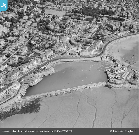
EAW025153 ENGLAND (1949). The Marine Lake, Weston-super-Mare, 1949
© Copyright OpenStreetMap contributors and licensed by the OpenStreetMap Foundation. 2024. Cartography is licensed as CC BY-SA.
Nearby Images (8)
EAW025153

EPW039937

EPW023968

EPW023963

EAW025148

EPW024073

EPW048450

EAW015054

Details
| Title | [EAW025153] The Marine Lake, Weston-super-Mare, 1949 |
| Reference | EAW025153 |
| Date | 25-July-1949 |
| Link | |
| Place name | WESTON-SUPER-MARE |
| Parish | WESTON-SUPER-MARE |
| District | |
| Country | ENGLAND |
| Easting / Northing | 331241, 162006 |
| Longitude / Latitude | -2.9875025385118, 51.352464319406 |
| National Grid Reference | ST312620 |


