
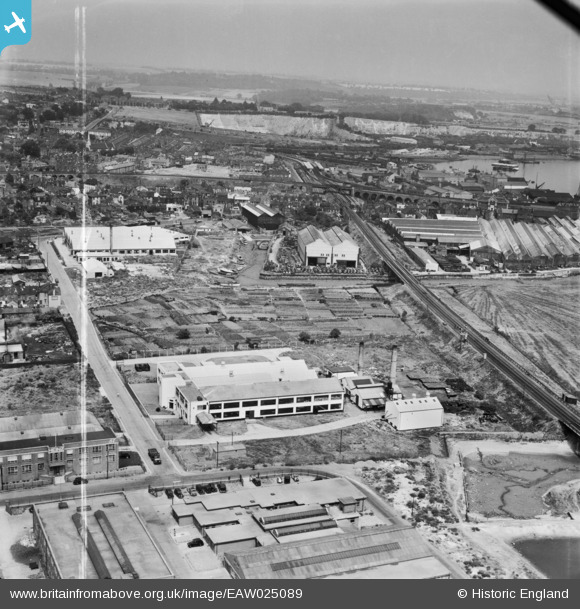
EAW025089 ENGLAND (1949). British Sisalkraft Ltd Paper Works and environs, Strood, from the south-west, 1949. This image was marked by Aerofilms Ltd for photo editing.
© Copyright OpenStreetMap contributors and licensed by the OpenStreetMap Foundation. 2024. Cartography is licensed as CC BY-SA.
Nearby Images (10)
EAW025089

EAW025087

EAW025092

EAW025091

EAW025085
 and environs, Strood, 1949. This image has been produced from a damaged negative.")
EAW025088

EAW025086

EAW025093

EAW025090

EPW060957

Details
| Title | [EAW025089] British Sisalkraft Ltd Paper Works and environs, Strood, from the south-west, 1949. This image was marked by Aerofilms Ltd for photo editing. |
| Reference | EAW025089 |
| Date | 22-July-1949 |
| Link | |
| Place name | STROOD |
| Parish | |
| District | |
| Country | ENGLAND |
| Easting / Northing | 573461, 168856 |
| Longitude / Latitude | 0.49348751239691, 51.391694758346 |
| National Grid Reference | TQ735689 |
Pins
 Paul |
Thursday 8th of July 2021 06:32:45 PM | |
Kentishman |
Monday 7th of March 2016 08:58:44 PM | |
Kentishman |
Monday 7th of March 2016 08:43:36 PM | |
Kentishman |
Saturday 14th of March 2015 09:10:56 AM |


