
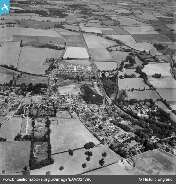
EAW024386 ENGLAND (1949). The town, Clare, from the west, 1949
© Copyright OpenStreetMap contributors and licensed by the OpenStreetMap Foundation. 2024. Cartography is licensed as CC BY-SA.
Nearby Images (3)
EAW024386

EAW024384

EAW024383

Details
| Title | [EAW024386] The town, Clare, from the west, 1949 |
| Reference | EAW024386 |
| Date | 6-July-1949 |
| Link | |
| Place name | CLARE |
| Parish | CLARE |
| District | |
| Country | ENGLAND |
| Easting / Northing | 576735, 245180 |
| Longitude / Latitude | 0.5792629498153, 52.07631566854 |
| National Grid Reference | TL767452 |
Pins
 Rock 54 |
Saturday 8th of May 2021 09:45:16 AM |


