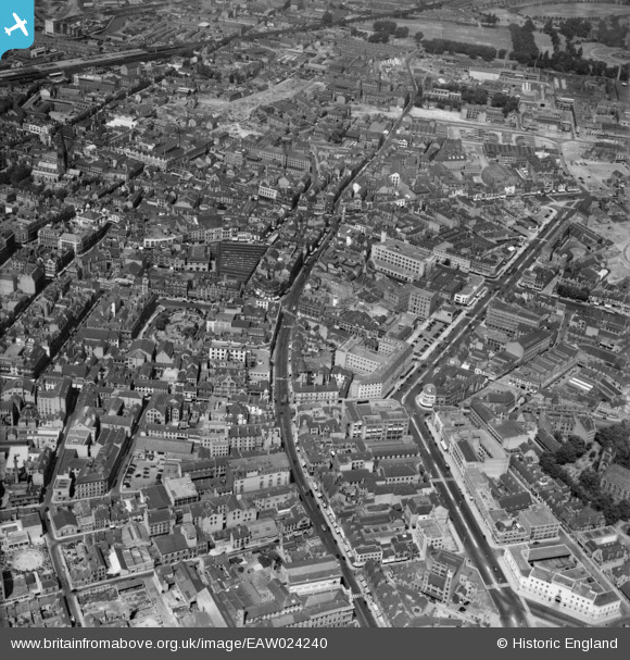
EAW024240 ENGLAND (1949). Charles Street, Granby Street and the city centre, Leicester, 1949
© Copyright OpenStreetMap contributors and licensed by the OpenStreetMap Foundation. 2024. Cartography is licensed as CC BY-SA.
Nearby Images (37)
EAW024240

EPW018431

EPW018436

EPW018412

EPW020892

EPW018421

EPW018422

EAW051834

EPW055011

EPW047868

EAW024244

EAW024242

EAW024239

EPW055002

EAW024243

EPW055009

EAW052680
 Factory on Charles Street, Leicester, 1953. This image was marked by Aerofilms Ltd for photo editing.")
EAW052674
 Factory on Charles Street, St George's Church and Rutland Street, Leicester, 1953. This image was marked by Aerofilms Ltd for photo editing.")
EPW018433

EAW052676
 Factory on Charles Street and St George's Church, Leicester, 1953. This image was marked by Aerofilms Ltd for photo editing.")
EPW047643

EPW061213

EPW020824

EAW052675
 Factory on Charles Street, Leicester, 1953. This image was marked by Aerofilms Ltd for photo editing.")
EPW047645

EPW061211

EAW052679
 Factory on Charles Street, Leicester, 1953. This image was marked by Aerofilms Ltd for photo editing.")
EPW020895

EPW047641

EPW020819

EAW052681
 Factory on Charles Street and St George's Church, Leicester, 1953. This image was marked by Aerofilms Ltd for photo editing.")
EPW020822

EPW020817

EPW055006

EPW020815

EPW055010

EPW020826

Details
| Title | [EAW024240] Charles Street, Granby Street and the city centre, Leicester, 1949 |
| Reference | EAW024240 |
| Date | 27-June-1949 |
| Link | |
| Place name | LEICESTER |
| Parish | |
| District | |
| Country | ENGLAND |
| Easting / Northing | 458890, 304445 |
| Longitude / Latitude | -1.129734241126, 52.634205453755 |
| National Grid Reference | SK589044 |