
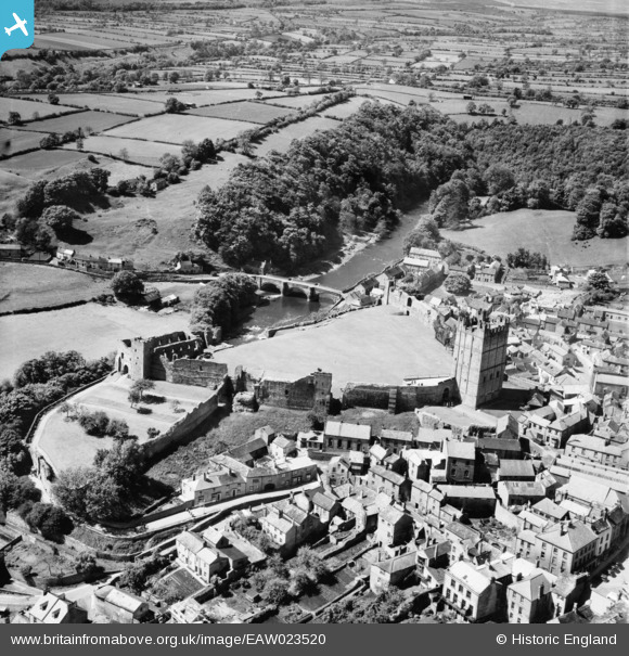
EAW023520 ENGLAND (1949). The Castle and River Swale, Richmond, 1949
© Copyright OpenStreetMap contributors and licensed by the OpenStreetMap Foundation. 2024. Cartography is licensed as CC BY-SA.
Nearby Images (17)
EAW023520

EAW005572

EAW023521

EAW009263

EAW009262

EAW005578

EAW009259

EAW005575

EAW005573

EAW009261

EPW019866

EPW019863

EAW009258

EAW009260

EAW005576

EAW005577

EAW023519

Details
| Title | [EAW023520] The Castle and River Swale, Richmond, 1949 |
| Reference | EAW023520 |
| Date | 28-May-1949 |
| Link | |
| Place name | RICHMOND |
| Parish | RICHMOND |
| District | |
| Country | ENGLAND |
| Easting / Northing | 416967, 500606 |
| Longitude / Latitude | -1.7386170087936, 54.400495078753 |
| National Grid Reference | NZ170006 |
Pins
Be the first to add a comment to this image!


