
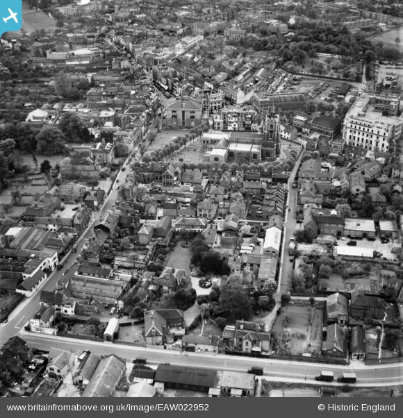
EAW022952 ENGLAND (1949). Cottage Place, New Street and St Mary's Cathedral, Chelmsford, 1949
© Copyright OpenStreetMap contributors and licensed by the OpenStreetMap Foundation. 2024. Cartography is licensed as CC BY-SA.
Nearby Images (17)
EAW022952

EAW022939

EAW022937
 on Cottage Place and St Mary's Cathedral, Chelmsford, 1949")
EAW022934
 on Cottage Place and Victoria Road, Chelmsford, 1949")
EAW022938
 on Cottage Place and Victoria Road, Chelmsford, 1949")
EAW022935
 on Cottage Place, the Telephone Exchange and environs, Chelmsford, 1949")
EAW022936

EAW050575

EAW022953

EAW049476

EAW043711

EAW043710

EAW001536

EAW049477

EAW001535

EAW022951

EAW001539

Details
| Title | [EAW022952] Cottage Place, New Street and St Mary's Cathedral, Chelmsford, 1949 |
| Reference | EAW022952 |
| Date | 6-May-1949 |
| Link | |
| Place name | CHELMSFORD |
| Parish | |
| District | |
| Country | ENGLAND |
| Easting / Northing | 570832, 207032 |
| Longitude / Latitude | 0.47428990969894, 51.735468653595 |
| National Grid Reference | TL708070 |
Pins
 Matt Aldred edob.mattaldred.com |
Wednesday 6th of March 2024 08:04:20 PM | |
Matt Aldred edob.mattaldred.com |
Friday 6th of October 2023 07:17:31 PM | |
Matt Aldred edob.mattaldred.com |
Friday 6th of October 2023 07:17:17 PM | |
 Ian |
Sunday 4th of January 2015 08:19:04 AM | |
Ian |
Saturday 11th of January 2014 04:02:21 PM | |
Ian |
Saturday 11th of January 2014 04:01:22 PM | |
Ian |
Saturday 11th of January 2014 03:59:38 PM | |
Ian |
Saturday 11th of January 2014 03:58:03 PM | |
Ian |
Saturday 11th of January 2014 03:57:34 PM | |
Ian |
Saturday 11th of January 2014 03:56:39 PM | |
Ian |
Saturday 11th of January 2014 03:55:53 PM | |
Ian |
Saturday 11th of January 2014 03:55:21 PM |


