
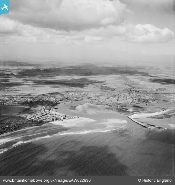
EAW022836 ENGLAND (1949). Calot Shad, River Tweed and the town, Berwick-upon-Tweed, from the south-east, 1949
© Copyright OpenStreetMap contributors and licensed by the OpenStreetMap Foundation. 2024. Cartography is licensed as CC BY-SA.
Nearby Images (2)
EAW022836

EAW022835

Details
| Title | [EAW022836] Calot Shad, River Tweed and the town, Berwick-upon-Tweed, from the south-east, 1949 |
| Reference | EAW022836 |
| Date | 30-April-1949 |
| Link | |
| Place name | BERWICK-UPON-TWEED |
| Parish | BERWICK-UPON-TWEED |
| District | |
| Country | ENGLAND |
| Easting / Northing | 400523, 652234 |
| Longitude / Latitude | -1.9916642896302, 55.763473491273 |
| National Grid Reference | NU005522 |
Pins
 redmist |
Wednesday 5th of October 2022 11:52:37 PM | |
redmist |
Wednesday 5th of October 2022 11:51:29 PM | |
redmist |
Tuesday 29th of October 2019 09:20:44 PM | |
redmist |
Tuesday 29th of October 2019 09:20:13 PM | |
redmist |
Tuesday 29th of October 2019 09:19:20 PM | |
redmist |
Tuesday 29th of October 2019 09:18:27 PM | |
redmist |
Tuesday 29th of October 2019 09:17:45 PM | |
redmist |
Tuesday 29th of October 2019 09:17:04 PM | |
redmist |
Tuesday 29th of October 2019 09:16:30 PM |


