
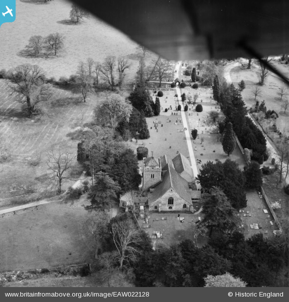
EAW022128 ENGLAND (1949). St Giles's Church, Stoke Poges, 1949
© Copyright OpenStreetMap contributors and licensed by the OpenStreetMap Foundation. 2024. Cartography is licensed as CC BY-SA.
Nearby Images (12)
EAW022128

EAW022122

EPW034732

EAW022121

EAW022127

EAW022120

EAW022125

EAW022124

EAW022126

EAW022123

EPW034731

EAW022118

Details
| Title | [EAW022128] St Giles's Church, Stoke Poges, 1949 |
| Reference | EAW022128 |
| Date | 14-April-1949 |
| Link | |
| Place name | STOKE POGES |
| Parish | STOKE POGES |
| District | |
| Country | ENGLAND |
| Easting / Northing | 497591, 182727 |
| Longitude / Latitude | -0.59281750382434, 51.534522707396 |
| National Grid Reference | SU976827 |
Pins
Be the first to add a comment to this image!


