
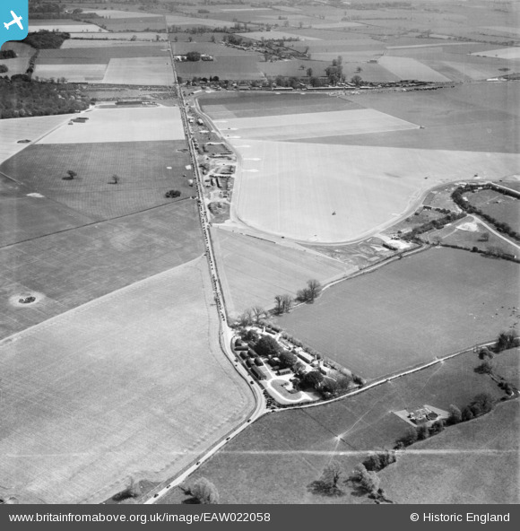
EAW022058 ENGLAND (1949). East Lavant, road traffic heading towards Goodwood Motor Circuit on a race day, 1949. This image was marked by Aerofilms Ltd for photo editing.
© Copyright OpenStreetMap contributors and licensed by the OpenStreetMap Foundation. 2024. Cartography is licensed as CC BY-SA.
Nearby Images (3)
EAW022058

EAW022057

EAW022056

Details
| Title | [EAW022058] East Lavant, road traffic heading towards Goodwood Motor Circuit on a race day, 1949. This image was marked by Aerofilms Ltd for photo editing. |
| Reference | EAW022058 |
| Date | 14-April-1949 |
| Link | |
| Place name | EAST LAVANT |
| Parish | LAVANT |
| District | |
| Country | ENGLAND |
| Easting / Northing | 486776, 107938 |
| Longitude / Latitude | -0.76680620975818, 50.863872253532 |
| National Grid Reference | SU868079 |
Pins
 Scorrybreck |
Sunday 16th of March 2014 09:16:43 PM |
User Comment Contributions
 Lavant corner at Goodwood. |
Scorrybreck |
Sunday 16th of March 2014 09:17:09 PM |


