
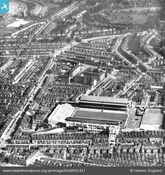
EAW021417 ENGLAND (1949). Highbury Football Stadium (Arsenal Football Club) and environs, Highbury, 1949. This image has been produced from a print.
© Copyright OpenStreetMap contributors and licensed by the OpenStreetMap Foundation. 2024. Cartography is licensed as CC BY-SA.
Nearby Images (14)
EAW021417
 and environs, Highbury, 1949. This image has been produced from a print.")
EAW021416
, Highbury, 1949. This image has been produced from a copy-negative.")
EAW021415
, Highbury, 1949. This image has been produced from a print.")
EPW009249

EPW009248

EAW021414
, Highbury, 1949. This image has been produced from a print.")
EPW025836

EPW025837

EPW030069

EPW025838

EPW025834

EPW009247

EPW025835

EAW021413
, Highbury, 1949. This image has been produced from a print.")
Details
| Title | [EAW021417] Highbury Football Stadium (Arsenal Football Club) and environs, Highbury, 1949. This image has been produced from a print. |
| Reference | EAW021417 |
| Date | 15-March-1949 |
| Link | |
| Place name | HIGHBURY |
| Parish | |
| District | |
| Country | ENGLAND |
| Easting / Northing | 531765, 186175 |
| Longitude / Latitude | -0.099018732722531, 51.558569112191 |
| National Grid Reference | TQ318862 |
Pins
 Greg Newsum |
Monday 20th of January 2020 10:35:13 PM | |
billyfern |
Saturday 4th of October 2014 01:21:16 PM | |
billyfern |
Saturday 4th of October 2014 01:20:44 PM | |
billyfern |
Saturday 4th of October 2014 01:20:18 PM | |
billyfern |
Saturday 4th of October 2014 01:19:56 PM | |
billyfern |
Saturday 4th of October 2014 01:19:35 PM | |
billyfern |
Saturday 4th of October 2014 01:19:15 PM | |
billyfern |
Saturday 4th of October 2014 01:18:54 PM |


