
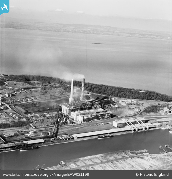
EAW021199 ENGLAND (1949). Portishead Power Station at Portishead Dock, Portishead, from the south-east, 1949
© Copyright OpenStreetMap contributors and licensed by the OpenStreetMap Foundation. 2024. Cartography is licensed as CC BY-SA.
Nearby Images (6)
EAW021199

EPW005556

EAW002076

EAW021198

EAW002075

EPW005557

Details
| Title | [EAW021199] Portishead Power Station at Portishead Dock, Portishead, from the south-east, 1949 |
| Reference | EAW021199 |
| Date | 2-March-1949 |
| Link | |
| Place name | PORTISHEAD |
| Parish | PORTISHEAD AND NORTH WESTON |
| District | |
| Country | ENGLAND |
| Easting / Northing | 347313, 177066 |
| Longitude / Latitude | -2.7589444291199, 51.489599526922 |
| National Grid Reference | ST473771 |
Pins
 Matt Aldred edob.mattaldred.com |
Monday 21st of March 2022 12:52:56 PM | |
 redmist |
Saturday 7th of November 2020 09:05:47 PM | |
redmist |
Saturday 7th of November 2020 09:04:17 PM | |
Sparky |
Saturday 26th of August 2017 02:27:25 PM | |
toriangel |
Saturday 23rd of July 2016 08:30:26 PM | |
toriangel |
Saturday 23rd of July 2016 08:28:42 PM | |
MB |
Sunday 17th of July 2016 02:57:54 PM | |
MB |
Sunday 17th of July 2016 02:57:27 PM | |
MB |
Sunday 17th of July 2016 02:55:33 PM | |
MB |
Sunday 17th of July 2016 02:54:15 PM | |
MB |
Sunday 17th of July 2016 02:53:36 PM | |
MB |
Sunday 17th of July 2016 02:53:14 PM | |
MB |
Sunday 17th of July 2016 02:51:58 PM |


