
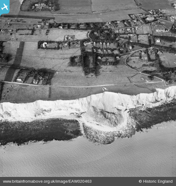
EAW020463 ENGLAND (1948). Foreland Road and environs, St Margaret's at Cliffe, 1948
© Copyright OpenStreetMap contributors and licensed by the OpenStreetMap Foundation. 2024. Cartography is licensed as CC BY-SA.
Nearby Images (3)
EAW020463

EAW020464

EAW020462

Details
| Title | [EAW020463] Foreland Road and environs, St Margaret's at Cliffe, 1948 |
| Reference | EAW020463 |
| Date | 9-November-1948 |
| Link | |
| Place name | ST MARGARET'S AT CLIFFE |
| Parish | ST. MARGARET'S AT CLIFFE |
| District | |
| Country | ENGLAND |
| Easting / Northing | 636561, 143803 |
| Longitude / Latitude | 1.3824951692179, 51.14400272759 |
| National Grid Reference | TR366438 |
Pins
 Kentishman |
Thursday 30th of September 2021 07:53:57 AM |


