
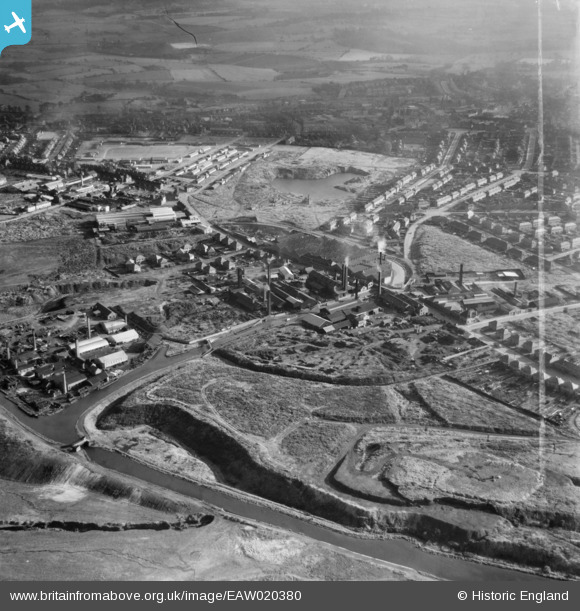
EAW020380 ENGLAND (1948). The Johnson's Iron & Steel Co Ltd Hall End Iron Works and environs, West Bromwich, 1948. This image was marked by Aerofilms Ltd for photo editing.
© Copyright OpenStreetMap contributors and licensed by the OpenStreetMap Foundation. 2024. Cartography is licensed as CC BY-SA.
Nearby Images (38)
EAW020380

EAW020379

EAW048801

EAW048808

EAW020381
, the Johnson's Iron & Steel Co Ltd Hall End Iron Works and environs, West Bromwich, 1948. This image was marked by Aerofilms Ltd for photo editing.")
EAW048809

EAW020374

EAW048805

EAW020376
 looking towards Black Lake, West Bromwich, from the south-east, 1948")
EAW020375

EAW048802

EAW048806

EAW020371
 and environs, West Bromwich, 1948")
EAW020370
 and environs, West Bromwich, 1948")
EAW048807

EAW048803

EAW048804

EAW020378

EAW042880

EAW042202

EAW042874

EAW042205

EAW042877

EAW042203

EAW042871

EAW042872

EAW020372

EAW042870

EAW042198

EAW042879

EAW042199

EAW020377

EAW042196

EAW042875

EAW042869

EAW042873

EAW042881

EAW020369

Details
| Title | [EAW020380] The Johnson's Iron & Steel Co Ltd Hall End Iron Works and environs, West Bromwich, 1948. This image was marked by Aerofilms Ltd for photo editing. |
| Reference | EAW020380 |
| Date | 4-November-1948 |
| Link | |
| Place name | WEST BROMWICH |
| Parish | |
| District | |
| Country | ENGLAND |
| Easting / Northing | 400118, 292686 |
| Longitude / Latitude | -1.9982602988854, 52.531677986341 |
| National Grid Reference | SP001927 |
Pins
 Martin |
Wednesday 25th of December 2013 08:36:55 PM |


