
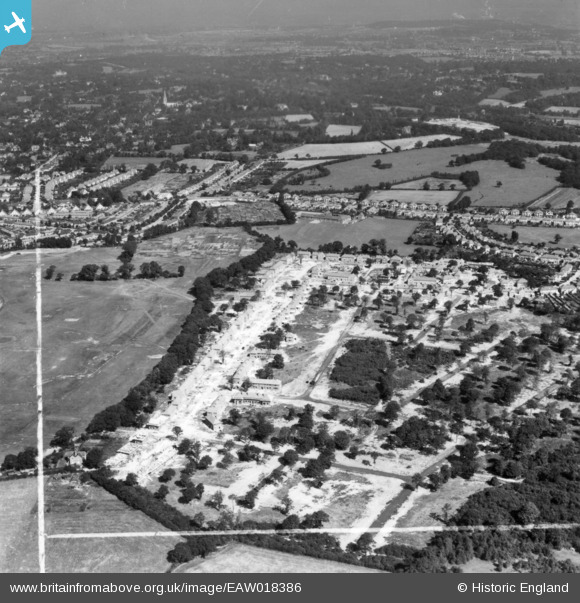
EAW018386 ENGLAND (1948). Construction of the Coppice Estate, Bromley, 1948. This image has been produced from a print marked by Aerofilms Ltd for photo editing.
© Copyright OpenStreetMap contributors and licensed by the OpenStreetMap Foundation. 2024. Cartography is licensed as CC BY-SA.
Nearby Images (6)
EAW018386

EAW018385

EAW018383

EAW018387

EAW018382

EAW018384

Details
| Title | [EAW018386] Construction of the Coppice Estate, Bromley, 1948. This image has been produced from a print marked by Aerofilms Ltd for photo editing. |
| Reference | EAW018386 |
| Date | 27-August-1948 |
| Link | |
| Place name | BROMLEY |
| Parish | |
| District | |
| Country | ENGLAND |
| Easting / Northing | 543196, 167207 |
| Longitude / Latitude | 0.058098940730186, 51.385322507182 |
| National Grid Reference | TQ432672 |
Pins
Be the first to add a comment to this image!


