
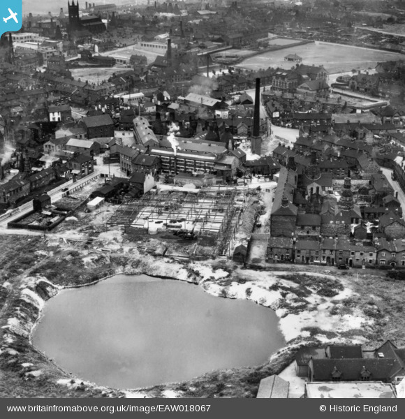
EAW018067 ENGLAND (1948). The Cartwright and Edwards Ltd Borough Pottery extension under construction and environs, Longton, 1948. This image has been produced from a print.
© Copyright OpenStreetMap contributors and licensed by the OpenStreetMap Foundation. 2024. Cartography is licensed as CC BY-SA.
Nearby Images (17)
EAW018067

EAW018071

EAW018072

EAW018066

EAW018073

EAW018068

EAW018065

EAW018069

EAW013142

EAW018064

EAW018070

EPW020079

EAW021611

EAW021614

EAW021610

EAW021613

EAW021612

Details
| Title | [EAW018067] The Cartwright and Edwards Ltd Borough Pottery extension under construction and environs, Longton, 1948. This image has been produced from a print. |
| Reference | EAW018067 |
| Date | 10-August-1948 |
| Link | |
| Place name | LONGTON |
| Parish | |
| District | |
| Country | ENGLAND |
| Easting / Northing | 390954, 343001 |
| Longitude / Latitude | -2.1347559642794, 52.983962923772 |
| National Grid Reference | SJ910430 |
Pins
 Nobby |
Sunday 25th of October 2015 09:53:37 PM |


