
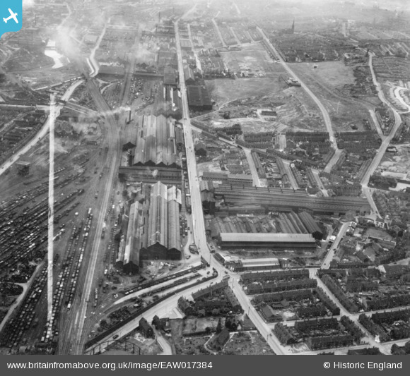
EAW017384 ENGLAND (1948). Grimesthorpe Steel Works and environs, Grimesthorpe, 1948. This image has been produced from a print marked by Aerofilms Ltd for photo editing.
© Copyright OpenStreetMap contributors and licensed by the OpenStreetMap Foundation. 2024. Cartography is licensed as CC BY-SA.
Nearby Images (9)
EAW017384

EAW017390

EAW017386

EAW017389

EAW017385

EAW017388

EAW017387

EAW017392

EAW017391

Details
| Title | [EAW017384] Grimesthorpe Steel Works and environs, Grimesthorpe, 1948. This image has been produced from a print marked by Aerofilms Ltd for photo editing. |
| Reference | EAW017384 |
| Date | 20-July-1948 |
| Link | |
| Place name | GRIMESTHORPE |
| Parish | |
| District | |
| Country | ENGLAND |
| Easting / Northing | 437570, 389842 |
| Longitude / Latitude | -1.4348323714009, 53.403798901118 |
| National Grid Reference | SK376898 |


