
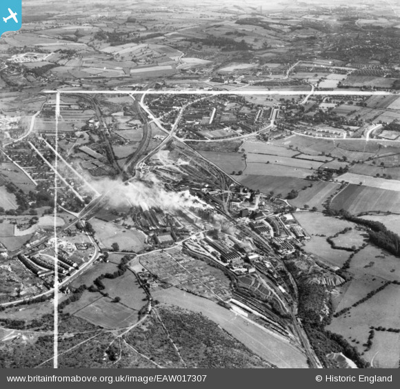
EAW017307 ENGLAND (1948). The Sheepbridge Iron Works and environs, Sheepbridge, 1948. This image has been produced from a print marked by Aerofilms Ltd for photo editing.
© Copyright OpenStreetMap contributors and licensed by the OpenStreetMap Foundation. 2024. Cartography is licensed as CC BY-SA.
Nearby Images (22)
EAW017307

EAW034555

EAW034556

EAW034559

EAW034557

EAW034553

EAW017309

EAW034551

EPW048952

EPW048956

EPW048954

EPW048955

EAW034567

EPW048957

EAW034562

EAW034552

EAW017308

EAW034554

EAW034563

EAW017311

EAW034560

EPW048951

Details
| Title | [EAW017307] The Sheepbridge Iron Works and environs, Sheepbridge, 1948. This image has been produced from a print marked by Aerofilms Ltd for photo editing. |
| Reference | EAW017307 |
| Date | 19-July-1948 |
| Link | |
| Place name | SHEEPBRIDGE |
| Parish | |
| District | |
| Country | ENGLAND |
| Easting / Northing | 437460, 374535 |
| Longitude / Latitude | -1.4382977394083, 53.266207859606 |
| National Grid Reference | SK375745 |
Pins
Be the first to add a comment to this image!


