
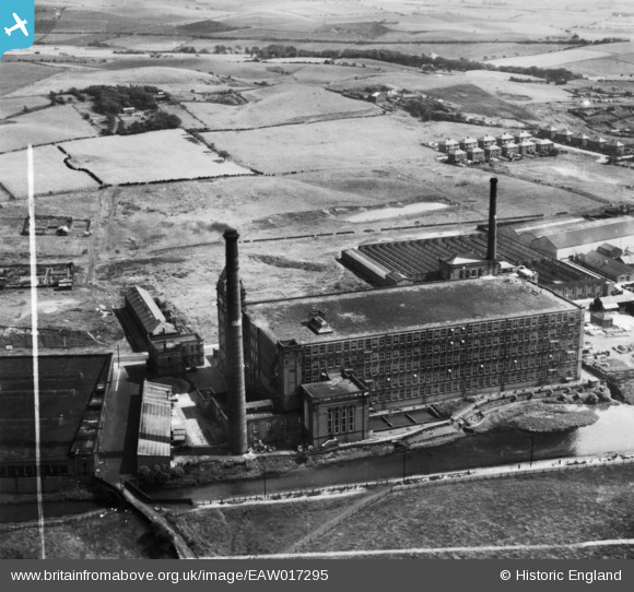
EAW017295 ENGLAND (1948). Courtaulds Ltd Arrow Mill, Castleton, 1948. This image has been produced from a print marked by Aerofilms Ltd for photo editing.
© Copyright OpenStreetMap contributors and licensed by the OpenStreetMap Foundation. 2024. Cartography is licensed as CC BY-SA.
Nearby Images (8)
EAW017295

EAW017296

EAW017292

EAW017293

EAW017294

EAW017298

EAW017291

EAW017297

Details
| Title | [EAW017295] Courtaulds Ltd Arrow Mill, Castleton, 1948. This image has been produced from a print marked by Aerofilms Ltd for photo editing. |
| Reference | EAW017295 |
| Date | 19-July-1948 |
| Link | |
| Place name | CASTLETON |
| Parish | |
| District | |
| Country | ENGLAND |
| Easting / Northing | 388694, 410890 |
| Longitude / Latitude | -2.1708398491683, 53.594224516306 |
| National Grid Reference | SD887109 |
Pins
User Comment Contributions
I believe that Arrow Mill was used as a viscose processing plant, receiving the yarn from its viscose production plants and using the skills of the local workforce, gained from years of cotton spinning, to process the viscose fibres to make them suitable for knitting and weaving. |
 Triggy |
Friday 17th of October 2014 09:47:14 PM |


