
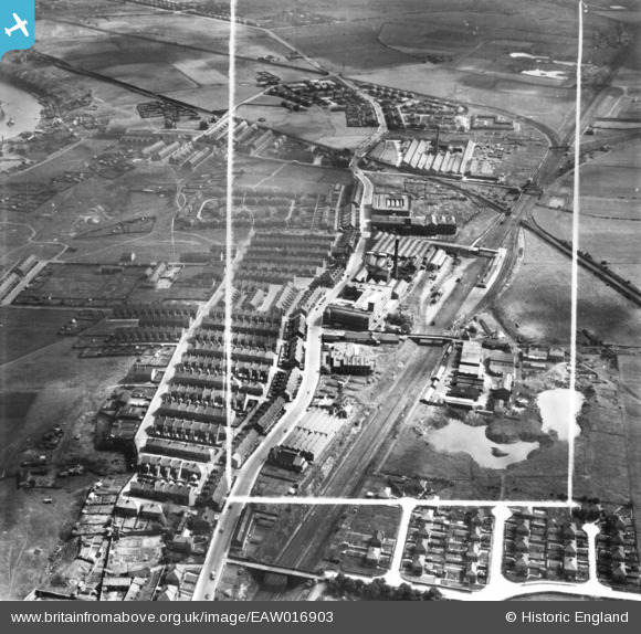
EAW016903 ENGLAND (1948). The Cooperative Wholesale Society Ltd Pelaw Works along Shields Road and environs, Pelaw, 1948. This image has been produced from a print marked by Aerofilms Ltd for photo editing.
© Copyright OpenStreetMap contributors and licensed by the OpenStreetMap Foundation. 2024. Cartography is licensed as CC BY-SA.
Nearby Images (17)
EAW016903

EAW016907
 and environs, Pelaw, 1948. This image has been produced from a print.")
EAW016900

EAW020548

EAW022499

EAW022496

EAW022501

EAW020549

EAW016906
 and environs, Pelaw, 1948. This image has been produced from a print marked by Aerofilms Ltd for photo editing.")
EAW022495

EAW020553

EAW022500

EAW022497

EAW020551

EAW022502

EAW020552

EAW020555

Details
| Title | [EAW016903] The Cooperative Wholesale Society Ltd Pelaw Works along Shields Road and environs, Pelaw, 1948. This image has been produced from a print marked by Aerofilms Ltd for photo editing. |
| Reference | EAW016903 |
| Date | 30-June-1948 |
| Link | |
| Place name | PELAW |
| Parish | |
| District | |
| Country | ENGLAND |
| Easting / Northing | 429244, 562208 |
| Longitude / Latitude | -1.5433189465587, 54.953580568433 |
| National Grid Reference | NZ292622 |
Pins
 Hamilton163 |
Wednesday 31st of August 2022 01:22:42 PM | |
Hamilton163 |
Wednesday 31st of August 2022 01:20:05 PM | |
Hamilton163 |
Wednesday 31st of August 2022 01:19:19 PM | |
redmist |
Thursday 24th of October 2019 09:41:59 PM | |
John Wass |
Sunday 4th of October 2015 08:26:02 PM |


