
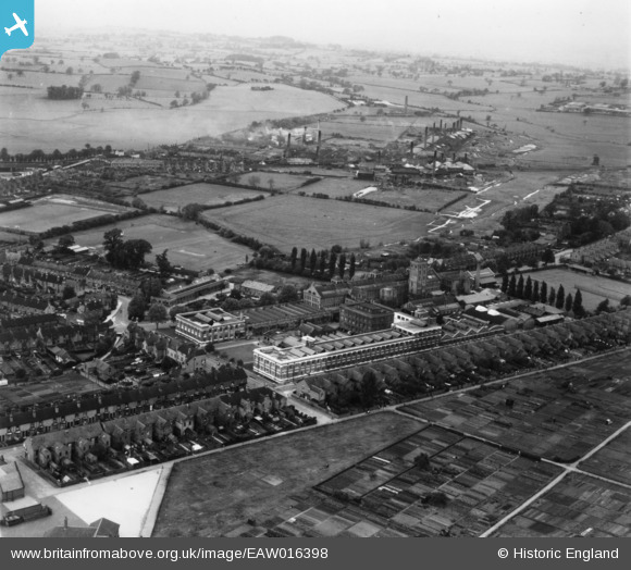
EAW016398 ENGLAND (1948). The Lotus Shoe Factory and environs, Stafford, from the south, 1948. This image has been produced from a print.
© Copyright OpenStreetMap contributors and licensed by the OpenStreetMap Foundation. 2024. Cartography is licensed as CC BY-SA.
Nearby Images (25)
EAW016398

EPW014118

EAW016403

EAW016404

EPW047665

EAW016402

EAW016405

EPW053372

EPW047670

EPW047667

EPW047669

EPW047322

EPW047663

EPW047326

EPW047664

EPW047320

EPW047321

EPW047325

EPW047323

EPW047666

EPW047668

EPW047319

EPW047324

EAW016407

EAW016406

Details
| Title | [EAW016398] The Lotus Shoe Factory and environs, Stafford, from the south, 1948. This image has been produced from a print. |
| Reference | EAW016398 |
| Date | 9-June-1948 |
| Link | |
| Place name | STAFFORD |
| Parish | |
| District | |
| Country | ENGLAND |
| Easting / Northing | 392513, 324216 |
| Longitude / Latitude | -2.1110992130562, 52.815103198019 |
| National Grid Reference | SJ925242 |
Pins
 stephen sweetie |
Wednesday 30th of January 2019 09:26:13 PM |


