
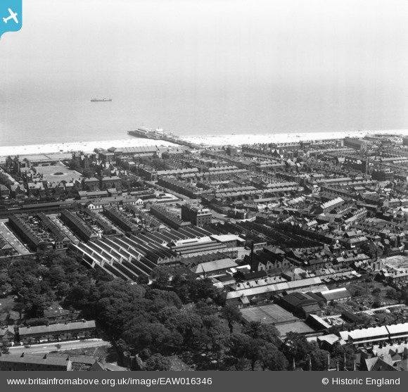
EAW016346 ENGLAND (1948). The Grout and Co Ltd Textile Factory and environs, Great Yarmouth, from the north-west, 1948. This image has been produced from a print.
© Copyright OpenStreetMap contributors and licensed by the OpenStreetMap Foundation. 2024. Cartography is licensed as CC BY-SA.
Nearby Images (29)
EAW016346

EAW052969

EAW016351

EAW052968

EAW052970

EAW016345

EAW052965

EAW016353

EAW016348

EAW052966

EAW052964

EAW016352

EAW052967

EPW008058

EAW016349

EPW008057

EAW016342

EAW052963

EAW016343

EAW052971

EPW008055

EPW008056

EPW008059

EAW016347

EPW021188

EAW016350

EAW016344

EAW016380

EAW052973

Details
| Title | [EAW016346] The Grout and Co Ltd Textile Factory and environs, Great Yarmouth, from the north-west, 1948. This image has been produced from a print. |
| Reference | EAW016346 |
| Date | 8-June-1948 |
| Link | |
| Place name | GREAT YARMOUTH |
| Parish | |
| District | |
| Country | ENGLAND |
| Easting / Northing | 652611, 308010 |
| Longitude / Latitude | 1.7316907925576, 52.610653211897 |
| National Grid Reference | TG526080 |


