
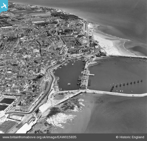
EAW015835 ENGLAND (1948). The town and seafront, Ramsgate, 1948. This image has been produced from a print.
© Copyright OpenStreetMap contributors and licensed by the OpenStreetMap Foundation. 2024. Cartography is licensed as CC BY-SA.
Nearby Images (23)
EAW015835

EAW017592

EPW018653

EPW018650

EAW006165

EPW000091

EAW006164

EAW015836

EAW009006

EPW000598

EPW000604

EAW009007

EAW009009

EPW035449

EPW000092

EAW009008

EPW039354

EPW000096

EAW009010

EPW052883

EPW048783

EAW017589

EAW009049

Details
| Title | [EAW015835] The town and seafront, Ramsgate, 1948. This image has been produced from a print. |
| Reference | EAW015835 |
| Date | 19-May-1948 |
| Link | |
| Place name | RAMSGATE |
| Parish | RAMSGATE |
| District | |
| Country | ENGLAND |
| Easting / Northing | 638332, 164679 |
| Longitude / Latitude | 1.4216597701935, 51.330670601424 |
| National Grid Reference | TR383647 |
Pins
 Alan McFaden |
Thursday 28th of August 2014 09:29:48 AM | |
Alan McFaden |
Thursday 28th of August 2014 09:29:07 AM | |
Alan McFaden |
Thursday 28th of August 2014 09:28:33 AM | |
Alan McFaden |
Thursday 28th of August 2014 09:27:52 AM | |
Alan McFaden |
Thursday 28th of August 2014 09:27:26 AM |


