
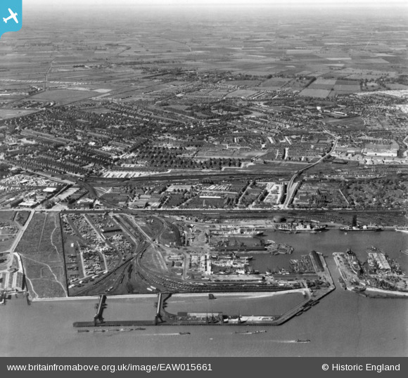
EAW015661 ENGLAND (1948). West Wharf and the Southcoates area, Marfleet, from the south, 1948. This image has been produced from a print.
© Copyright OpenStreetMap contributors and licensed by the OpenStreetMap Foundation. 2024. Cartography is licensed as CC BY-SA.
Nearby Images (5)
EAW015661

EAW046139

EAW004505

EPW010818

EPW036555

Details
| Title | [EAW015661] West Wharf and the Southcoates area, Marfleet, from the south, 1948. This image has been produced from a print. |
| Reference | EAW015661 |
| Date | 18-May-1948 |
| Link | |
| Place name | MARFLEET |
| Parish | |
| District | |
| Country | ENGLAND |
| Easting / Northing | 512080, 429048 |
| Longitude / Latitude | -0.30025791872987, 53.745519777344 |
| National Grid Reference | TA121290 |
Pins
 ladyceecee |
Friday 8th of February 2019 09:48:26 PM | |
ladyceecee |
Friday 8th of February 2019 09:38:02 PM | |
ladyceecee |
Friday 8th of February 2019 09:36:54 PM | |
ladyceecee |
Friday 8th of February 2019 09:32:30 PM | |
ladyceecee |
Friday 8th of February 2019 09:30:32 PM | |
redmist |
Thursday 10th of January 2019 11:24:41 PM | |
redmist |
Thursday 10th of January 2019 11:22:34 PM | |
redmist |
Thursday 10th of January 2019 11:04:21 PM | |
John Wass |
Sunday 14th of September 2014 07:54:28 PM | |
John Wass |
Sunday 14th of September 2014 07:53:43 PM | |
John Wass |
Sunday 14th of September 2014 07:48:10 PM | |
John Wass |
Sunday 14th of September 2014 07:26:24 PM |


