
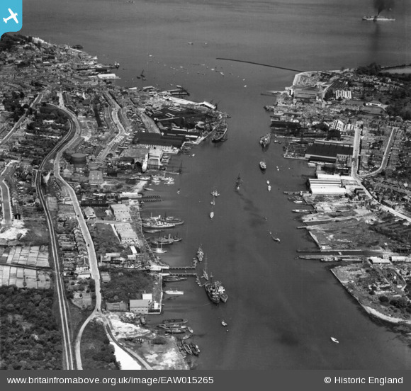
EAW015265 ENGLAND (1948). The River Medina and Cowes Harbour, Cowes, 1948
© Copyright OpenStreetMap contributors and licensed by the OpenStreetMap Foundation. 2024. Cartography is licensed as CC BY-SA.
Nearby Images (10)
EAW015265

EPW022951

EAW025032

EAW022231

EAW025029

EPW023056

EAW022229

EAW025035

EAW025030

EAW025031

Details
| Title | [EAW015265] The River Medina and Cowes Harbour, Cowes, 1948 |
| Reference | EAW015265 |
| Date | 6-May-1948 |
| Link | |
| Place name | COWES |
| Parish | COWES |
| District | |
| Country | ENGLAND |
| Easting / Northing | 449949, 95185 |
| Longitude / Latitude | -1.2918407282042, 50.753542139119 |
| National Grid Reference | SZ499952 |
Pins
 brianbeckett |
Wednesday 3rd of June 2020 05:40:26 PM | |
ken |
Monday 27th of July 2015 01:42:12 PM | |
ken |
Thursday 2nd of July 2015 10:42:24 AM | |
MB |
Saturday 25th of January 2014 03:32:07 PM | |
MB |
Saturday 25th of January 2014 03:30:44 PM | |
MB |
Saturday 25th of January 2014 03:29:00 PM |


