
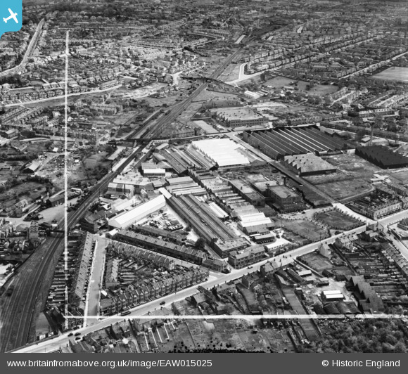
EAW015025 ENGLAND (1948). Factories off Lodge Causeway and Goodneston Road, Fishponds, 1948. This image image was marked by Aerofilms Ltd for photo editing.
© Copyright OpenStreetMap contributors and licensed by the OpenStreetMap Foundation. 2024. Cartography is licensed as CC BY-SA.
Nearby Images (29)
EAW015025

EAW005355

EAW005364

EAW015029

EAW015027

EAW005356

EAW015028

EPW014738

EAW005360

EAW005358

EAW005352

EAW005361

EAW015023

EAW005350

EAW005351

EAW005363

EAW005353

EAW005362

EAW005357

EAW005359

EAW015024

EAW015026

EPW014739

EAW005354

EAW032266

EAW032262

EAW032269

EAW032264

EAW032263

Details
| Title | [EAW015025] Factories off Lodge Causeway and Goodneston Road, Fishponds, 1948. This image image was marked by Aerofilms Ltd for photo editing. |
| Reference | EAW015025 |
| Date | 27-April-1948 |
| Link | |
| Place name | FISHPONDS |
| Parish | |
| District | |
| Country | ENGLAND |
| Easting / Northing | 363252, 175439 |
| Longitude / Latitude | -2.5291901626945, 51.476230215116 |
| National Grid Reference | ST633754 |
Pins
 Class31 |
Saturday 22nd of March 2014 06:09:40 PM | |
Class31 |
Friday 28th of February 2014 03:46:01 PM | |
Class31 |
Friday 28th of February 2014 09:55:05 AM | |
Class31 |
Friday 28th of February 2014 09:47:37 AM | |
 Horace |
Wednesday 26th of February 2014 06:19:19 PM | |
Horace |
Wednesday 26th of February 2014 06:17:52 PM | |
Horace |
Wednesday 26th of February 2014 06:17:04 PM |


