
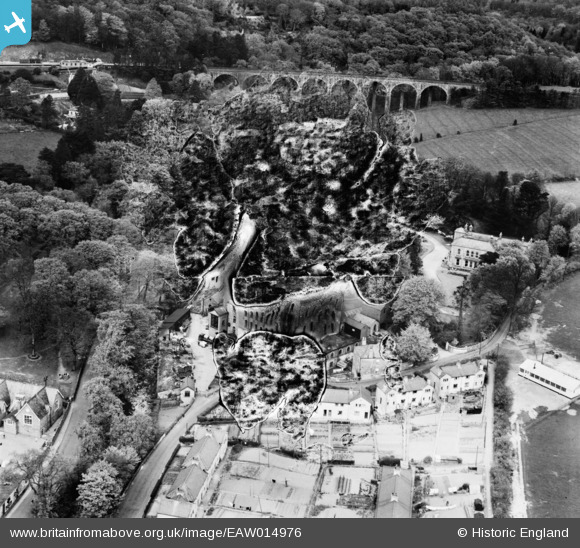
EAW014976 ENGLAND (1948). Stowford Paper Mills and environs, Ivybridge, 1948. This image has been produced from a damaged negative.
© Copyright OpenStreetMap contributors and licensed by the OpenStreetMap Foundation. 2024. Cartography is licensed as CC BY-SA.
Nearby Images (7)
EAW014976

EAW014973

EAW014972

EAW014974

EAW014977

EAW014978

EAW014975

Details
| Title | [EAW014976] Stowford Paper Mills and environs, Ivybridge, 1948. This image has been produced from a damaged negative. |
| Reference | EAW014976 |
| Date | 27-April-1948 |
| Link | |
| Place name | IVYBRIDGE |
| Parish | IVYBRIDGE |
| District | |
| Country | ENGLAND |
| Easting / Northing | 263633, 56554 |
| Longitude / Latitude | -3.9186959495008, 50.392423321118 |
| National Grid Reference | SX636566 |
Pins
 Tim |
Friday 14th of November 2014 06:09:41 PM |


