
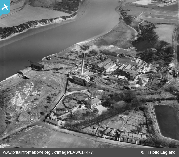
EAW014477 ENGLAND (1948). The Ford Paper Mill, South Hylton, 1948
© Copyright OpenStreetMap contributors and licensed by the OpenStreetMap Foundation. 2024. Cartography is licensed as CC BY-SA.
Nearby Images (13)
EAW014477

EAW014469

EAW014471

EAW014476

EAW014470

EAW014475

EAW014472

EAW014474

EAW014479

EAW014478

EPW016428

EAW014473

EPW016427

Details
| Title | [EAW014477] The Ford Paper Mill, South Hylton, 1948 |
| Reference | EAW014477 |
| Date | 15-April-1948 |
| Link | |
| Place name | SOUTH HYLTON |
| Parish | |
| District | |
| Country | ENGLAND |
| Easting / Northing | 435941, 557415 |
| Longitude / Latitude | -1.4393415598667, 54.910068694169 |
| National Grid Reference | NZ359574 |
Pins
Be the first to add a comment to this image!


