
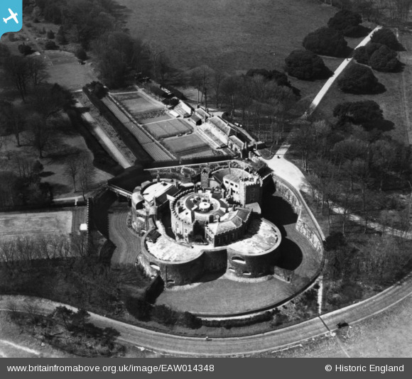
EAW014348 ENGLAND (1948). Walmer Castle, Walmer, 1948. This image has been produced from a print.
© Copyright OpenStreetMap contributors and licensed by the OpenStreetMap Foundation. 2024. Cartography is licensed as CC BY-SA.
Nearby Images (10)
EAW014348

EAW014350

EPW009207

EPW035525

EAW014351

EAW014352

EAW014347

EAW014349

EPW035431

EAW020485

Details
| Title | [EAW014348] Walmer Castle, Walmer, 1948. This image has been produced from a print. |
| Reference | EAW014348 |
| Date | 13-April-1948 |
| Link | |
| Place name | WALMER |
| Parish | WALMER |
| District | |
| Country | ENGLAND |
| Easting / Northing | 637735, 150102 |
| Longitude / Latitude | 1.4034150175795, 51.200063531465 |
| National Grid Reference | TR377501 |
Pins
Be the first to add a comment to this image!


