
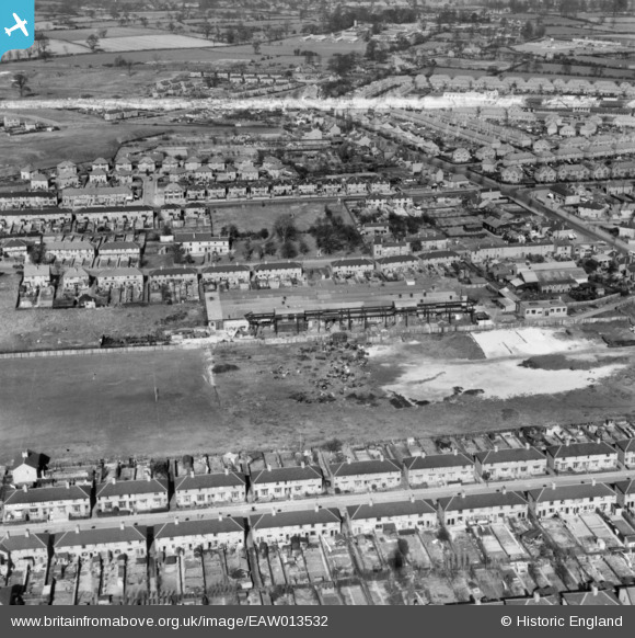
EAW013532 ENGLAND (1948). The Brico Foundry and the surrounding residential area, Holbrooks, 1948. This image has been produced from a print marked by Aerofilms Ltd for photo editing.
© Copyright OpenStreetMap contributors and licensed by the OpenStreetMap Foundation. 2024. Cartography is licensed as CC BY-SA.
Nearby Images (12)
EAW013532

EPW056084

EAW013536

EAW013539

EAW013534

EPW056085

EAW013540

EAW013538

EAW013535

EAW013537

EAW013541

EAW013533

Details
| Title | [EAW013532] The Brico Foundry and the surrounding residential area, Holbrooks, 1948. This image has been produced from a print marked by Aerofilms Ltd for photo editing. |
| Reference | EAW013532 |
| Date | 9-March-1948 |
| Link | |
| Place name | HOLBROOKS |
| Parish | |
| District | |
| Country | ENGLAND |
| Easting / Northing | 433250, 283113 |
| Longitude / Latitude | -1.5107532913301, 52.44459533462 |
| National Grid Reference | SP333831 |
Pins
 CA |
Thursday 26th of August 2021 07:54:53 PM | |
CA |
Thursday 26th of August 2021 07:52:56 PM | |
CA |
Thursday 26th of August 2021 07:52:35 PM | |
CA |
Thursday 26th of August 2021 07:51:57 PM | |
CA |
Thursday 26th of August 2021 07:51:34 PM | |
CA |
Thursday 26th of August 2021 07:49:42 PM |


